Sunday, February 20, 2011

HUNTER VALLEY: GOLF AND WINE


TWO OUT OF MANY HUNTER VALLY MODERN WINERIES.


Before leaving for Sydney we played a round of golf at the Hunter Valley Golf and Country club, a pretentious name that did not live up to its lofty promise. For example, at the time we visited there was no golf clubhouse, as the facility was alleged to be under redevelopment — but there was not much earth being moved that I could see. However, the golf course was fair and reasonable, with a round costing about $35 each. We also visited a resort development associated with Greg Norman. It had potential but oddly, although almost all the currently available lots were sold, only two houses had been built. As in the rest of Australia, there seems to be a lot of property speculation, with, I believe, most people buying the lots in hope of selling them later…perhaps only building if development really takes off. It doesn’t give a prospective purchaser a very good feeling about buying in. Besides, I later learned that the Hunter Valley has only two seasons, spring and fall, with summer temperatures often going above 100 degrees. It was likened to Phoenix in the summer; very hot and dry.

Thursday morning in August found us almost alone in the valley. It was a pleasant day, with temperatures in the mid 60s, but there were very few people about. Hunter Valley competes with many other wine regions we visited spread throughout Australia: south near Adelaid, on the west coast below Perth, the Borrosa valley and so forth. But Hunter Valley is likely to be the oldest, given its proximity to Sydney. Since neither Elysee nor I are one’s to gush over visiting wineries, we selected a couple small tasting rooms, bought a bottle as a gift for our host at Friday’s dinner party, and left for Sydney, my guide and companion insisting we drive only during daylight hours. Elysee’s wine tasting lexicon is still on my mind:

Color: Bruised Purple Thigh
Nose: Snotty
Palette: Wet
Taste: Wood chips and computer chips (maybe some potato chips)
Enjoy now or cellar for 5 to 8 years at an annual return of 3.5

Sunday, January 23, 2011

HUNTER VALLEY WINE: I'LL GET TO THAT SOON


THIS IS THE PROTESTANT CHURCH WOOLOMBI, BUILT NEARBY THE CATHOLIC CHURCH ABOUT THE SAME TIME.

Excerpted from Our Summer In Australia and New Zealand, Amazon.com


Woolombi, which means “meeting place” in the Aborigine language, is typical of a
settlement in early to middle 19th century rural Australia. At one time, the valley had a population of over 2,000 with over 200 in the Woolombi township itself. Initially a wheat growing region, the town was developed with permanence in mind, such as having the unusual combination of an Anglican and Catholic Church, both built in the 1840s. In 1893, a disastrous flood severely damaged the wheat crop, and growing of grain was abandoned in favor of grazing, in addition many people were by then working in the numerous collieries throughout the Hunter region.There is much evidence of the primacy of coal to the economy in the small, but quaint, Wollombi museum, which occupies the courthouse, built in 1866.

How things change. Cessnock, in the mid 1800s had a population of about twenty.
Today, Wollombi is an almost deserted crossroads… an artifact of the past, with but a few remaining buildings, and almost no inhabitants. Cessnock, the entry town to the Hunter Valley wine region, now has a population approaching 20,000. Elysee and I stayed at Harrigan’s, a prosperous and growing hotel, newly built in 2001, which featured a rather authentic Irish pub, as well as Irish cooking. Being off season, we received a very good rate of $85 a night, including a full Irish breakfast. Needless to say, Harrigan’s was the center for nightlife, especially at this time of year.

While in the pub, I had the pleasure of witnessing a busload of about thirty newly-made Australian Infantry privates, who came in to celebrate their graduation, after 21 weeks of training at a nearby infantry school. They were with their Platoon Sergeant and Lieutenant, and had been “taxed” a small amount each week during their training ordeal, in anticipation of this brief afternoon of revelry and release; their rite of passage. The Platoon Sergeant put $700 dollars on the bar, announcing they had only three hours to drink it up, “so get with it”. What a command to give a platoon of dried out Aussies who had not been near a beer for months. They began as a somewhat docile, orderly but expectant group, not quite sure if their Sergeant really meant what he said. Elysee and I also saw them at the stroke of their three hour “times-up”.They were a roaring, swaying, jovial mob, a staggering amoeba-like mated mass boarding the bus whose singing only faded away when the bus was far down the road.

Tuesday, December 21, 2010

HUNTER VALLEY WINE REGION


NOT LACKING FOR STONE THE WOOLOMBI CATHOLIC CHURCH HAS STOOD FORTRESSLIKE ON THE NORTH ROAD SINCE THE 1840S

EXCERPTED FROM MY BOOK: OUR SUMMER IN AUSTRALIA & NEW ZEALAND


The Hunter Valley region lies between 150 and 200km north of Sydney…about a
two hour drive. Today, one might compare it to Napa Valley, in relation to San Francisco. A premier wine growing region of many independent vineyards, numerous B & Bs, restaurants, balloon rides, music festivals, a few golf resorts and several wine tasting tours. That’s today. Yesterday was quite different.

In 1798, coal was discovered, by a British officer, Lt. Shortland, while in pursuit of escaped convicts. It was he who named the region after then Governor Capt. John Hunter, R.N., But it wasn’t until 1804, following a convict uprising near Sydney, that the subsequent Governor, Lt. Phillip King, R.N. decided to establish a penal colony at Newcastle, where second offenders would mine the coal and fell the abundant cedar timber, assuming the hard labor would deter others. It was harsh treatment, but ultimately not effective in its intended purpose. Fifteen years, later there were 850 assigned second offenders.

By the 1820s, settlers had expanded into the fertile areas, growing wheat and other
crops desired in Sydney, as well as raising the usual cattle and sheep. The only means of transporting their products and themselves to Sydney was by ship from Newcastle. Therefore, they petitioned the government for a road to be constructed, connecting them to Sydney, 150km away. A formidable task, across rivers and streams and over mountains, in an area offering no natural subsistence, much less shelter, using the most primitive tools. This, at a time when a bullock and a cart would make good time covering 15km in a day, and a man alone on horseback might make Sydney in four. But the scheme had the advantage of getting the convicts away from Newcastle, providing backbreaking labor in appalling conditions, and thereby serving the public good. With construction starting in 1826, and lasting for ten years, what become known as the Great North Road was built using convict labor, with as many as 750 prisoners working on the project at any one time, often still in leg irons weighing 10 to 12 pounds. Today, you can still travel across many of the 30 plus bridge sites, past culverts and walls cut from stone, some weighing over 600kg. As is our practice, Elysee and I branched off from the main road to the Hunter Valley, and followed the convict road to the village of Wollombi, about a twenty minute drive from the central grape growing region of the area.

Saturday, July 31, 2010

AUSTRALIAN WAR MEMORIAL-CANBERRA


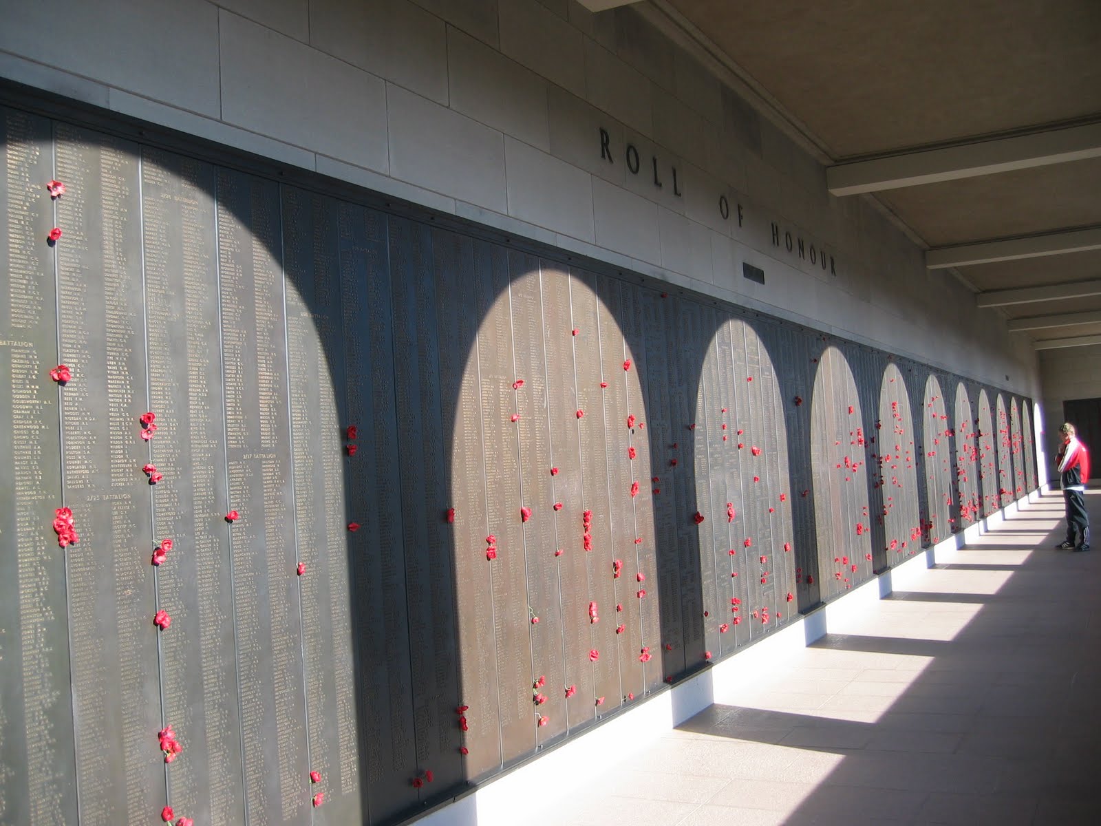
The walls contain the names of all Australian war dead. Poppies are placed by family and friends to commemorate important dates.


The imposing memorial, Tomb of the Unknown in center, memorial walls on each side and a museum in the vast space underneath.

Excerpted from my book OUR SUMMER IN AUSTRALIA AND NEW ZEALAND, Amazon.com


The Australian War Memorial, is located directly opposite from Parliament House. These two buildings face each other in a dramatic way. Politicians, from there exalted hilltop site, deliberating on decisions to go to war, need only to look out their window and across the lake at the imposing War Memorial, to be reminded of the consequences. I have visited “Tombs of the Unknown Soldier” in many countries… France, Great Britain, United States, Italy, Turkey and so on. The Australian War Memorial surpasses them all, not only in its respect for the hardships of those who served — particularly in the two World Wars of the last century— but also in the direct, realistic and unadorned manner in which the story of the combatant is told. As in other Tombs of the Unknown, Australia’s is also rendered tastefully and with dignity.

However, unlike the Tomb of the Unknown at Arlington Cemetery, this memorial is without an interposing honor guard, and is covered from the elements while still remaining open, allowing anyone to approach and pay their respects. Also, and very wisely, the Australian Tomb contains the remains of only one serviceman, a soldier from the First World War, representing every unknown serviceman from all of Australia’s conflicts. The gravesite is symbolic, not specific. Unlike the United States, which has an Unknown Soldier gravesite for WWI, WWII, and Korea, resulting in an ongoing controversial opening of the graves, to subject the remains to modern DNA identification analysis. The Australian example is dignified, complete, and without political sentiment.

What further distinguishes the Australian War Memorial is the amazing museum located beneath the building. It’s a vast space, even containing twin engine bombers from
WWII, and realistic displays of a soldier’s life, from Australia’s first overseas encounter in the Boer war, through their participation in Vietnam. It is not simply a collection of captured enemy equipment, but more a paean to the serviceman’s life in combat, told through hundreds of photographs and large dioramas. It doesn’t glorify. It doesn’t put flag rank officers on pedestals. It does honor genuine heroism. You leave shaking your head at what men, and in several examples, women, endured. Also, you better understand the Australian concept of “mateship”, and everyone having a “fair go.” Of course, men from other nations also bond together to mutually endure the hardships of prolonged combat, but it comes through so forcefully in the ANZAC photographs, reinforcing the statement that, at Gallipoli, the Australian nation was born.

By combining their tomb of the unknown soldier with a memorial museum, and in such a dignified, respectufl and somber fashion, the Australians have got it right, and set an example for others, including the United States.

Thursday, July 22, 2010

CANBERRA: CHICAGO LANDSCAPER DESIGNED NEW CAPITAL


Parliment Building. Citizens can walk over the building using stairs on either side. Note people on top of the building. Aussies like the idea that they have the only Parliment in the world where the citizens can "walk all over their politicians."


Lake Griffen. City at the left and governmenmt building across the lake to the right.


Excerpted from my book OUR SUMMER IN AUSTRALIA AND NEW ZEALAND amazon.com

A little history. When Australia federated in 1901, there was a raging debate between
Sydney and Melbourne as to which city should be the new nation’s capital. Being
unsolvable, it was decided to find a new location within the state of New South Wales, provided it was no closer than 100 miles to Sidney. Those from Melbourne were determined to prevent Sydneysiders from profiting from the new capital, and in those days, 100 miles (or about 160 km) was sufficient distance to deny any useful commercial connection.

A committee was formed to recommend a location, and after a long search of about
40 sites, the small settlement of Canberra was chosen, and almost 925 surrounding square miles were set aside for what is now known as the Australian Capital Territory. By the way, in Aussie the pronunciation is “kain-bruh,” an offshoot of an aboriginal word fittingly meaning “meeting place.”

In 1909, an international competition was conducted to select a designer for the new
city, and from 137 entries, Chicago landscape architect, Walter Burley Griffin, who had never been to Australia, was awarded the contract. What an opportunity! A totally blank canvas upon which to design a nation’s capital — and the resulting Canberra is widely regarded as the most successfully planned city in the world. The main features of Griffin’s plan were an artificially created lake, a federal triangle, (not quite similar to L’Enfant’s design for Washington D.C., but capitalizing on the general idea) broad avenues and many parks, with residential and commercial space opposite the triangle of buildings on the
other side of the lake.

Griffin arrived in 1913, but quit in 1920, over disagreements in design changes. The
work progressed slowly thereafter, interrupted by two World Wars and the Depression, but in 1927, a temporary Parliament building was finally completed, and the government moved from Melbourne. In 1963, Lake Burley Griffin was finally finished, and in 1988, almost sixty years from the opening of its temporary building, the new parliament building was opened, essentially completing Griffin’s plans. Despite Australian criticism of Canberra being provincial, boring, and nothing but a politician’s town, I believe Griffin succeeded admirably.

Sunday, April 18, 2010

CAMELS IN AUSTRALIA-PART TWO


LAST VIEW OF AYERS ROCK FROM RINGEE


RINGEE SINGING HIS MORNING SONG WITH AYERS ROCK AS BACKGROUND AS WE POSE IN THOSE STUPID HELMETS


EXCERPTED FROM MY BOOK: OUR SUMMER IN AUSTRALIA & NEW ZEALAND, AMAZON.COM

The camels our group rode were 8 to 10 years old, and very well behaved. After all,
considering what they might be made to carry in the old days, we were a very light load for a short ride. An easy day for the camels, so they’d better behave! Our camel was named Ringee,and just our luck, he had an attitude.

When first brought to this camp from Alice Springs,300 miles away, Ringee did not like one of the drivers, peed all over him and drove him from the pen. He also refused to eat. The owners, who are camel careerists, and dearly love them,determined that Ringee’s problem was being separated from his friend of many years, so he was on a hunger strike. Once Ringee and his “mate” were reunited, everything was fine. The driver who Ringee had literally “pissed off” was advised by the owner to return to the pen,and pee on Ringee’s leg. Ringee had to be shown who was in charge! The driver was new to this line of work, and wasn’t sure if he was about to have his own leg peed on twice. But with courage, he took the advice; looked that 400 pound camel in the eye and peed on its leg. It worked! Ringee mellowed, and has been less of a problem since. I would give a lot to see the
photo of this guy looking that huge camel in the eye and calmly pissing on its leg.

We journeyed into the desert, being informed along the way about all the deadly
plants and vermin we were riding by, a tactic I really think was designed to keep us in our saddles, making it easier for the driver. The pace was relaxed, and not at all like some of the tales you hear, as camels are capable of over 40mph, which I can imagine could be quite an experience. I was just thankful Ringee had an attitude change, and was conducting himself as any competent camel should.

Except for the ridiculous helmets we were required to wear because of recent insurance provisos, the camel ride turned out not to be a “silly tourist” attraction, after all. We came away with a large measure of respect for these animals, and had fun, too.

We left Ayers Rock later that day for Sydney, only another 1700 miles, arriving home in Coogee Beach at 6:30pm, in time for our dull but satisfying routine, the evening news and a cocktail.

As a result of our twelve day crisscrossing of the continent we’re seven thousand miles wiser, and more appreciative than ever of what a fine place this Australia is.

Sunday, February 21, 2010

CAMELS IN AUSTRALIA. Day 12 of Crisscrossing Australia


OUR CAMEL, RINGEE


Excerpted from my book OUR SUMMER IN AUSTRALIA Amazon.com

Day Twelve. Alright, this is the last day of the journey, so, how about a desert sunrise camel ride, or more factually; a dromedary ride of the one humped type.

ALL ABOUT THE CAMELS. The camel ride was not at all an inane tourist attraction, and I came away with a great respect for these animals. They were very instrumental in the development of early Australia. Initially brought in from Northern India, they immediately proved their value in the hot and dry interior of the country. Able to travel for 300-400 km without water, while carrying five times their weight, they were ideal for tasks such as bringing water to parched miners and hauling large quantities of wool from ranches — some over a thousand from miles from the nearest port. They served as pack animals for expanding the railroads into the interior, and pulled wagons and carriages more efficiently than horses. Some camels have been recorded as going over 650km (400 miles) and two weeks without water. Their demands are small — they can graze on most anything, unlike the horse. They can even drink salt water with no ill effect. After six or eight days of steady work, they need a day’s rest, and then they’re ready to move on. When water becomes available they will fill up with a 100 or so liters, which they can swallow in just a few minutes. They have a long life, well beyond 25 years, if well treated. They’re noted for a discerning personality, for if they don’t like you they will soon let you know by biting or peeing on you. Yet they are very loyal, forming lifelong companionships with other camels and drivers, from which they don’t like to be separated. They are communal animals, and do best with several more camels around them.

CAMELS IN AUSTRALIA. The Australians soon learned it was better to employ drivers that knew how to handle these independently minded animals. They brought in hundreds of Afghans, or in strine, “Ghans,” (that actually were from present day Pakistan) to manage the growing herds. So numerous were the Ghans in the 19th century, one still occasionally comes across a 19thcentury mosque, such as the one I saw in Broken Hill; a poignant reminder of the deep faith of Muslims. Eventually, with the railroad, improved highways, and finally the automobile, the need for camels decreased, and they were turned loose into the vast interior wilderness. That was wonderful! What a great retirement home —natural habitat, no predatory enemies, and best of all, no drivers or work. The cameleers, now without employment and in an alien country, by and large returned to their homeland, but some descendants remain in the outback today.

Presently, Australia has more wild camels than any other country, exports live camels, and camel meat has recently been approved for export. The camel population is increasing, but so far there is no cause for alarm, as they have little harmful effect on the land, in terms of over grazing, or invading inhabited areas. There are no reliable figures, but one government estimate has about 600,000 wild camels enjoying one helluva good time out there!

NEXT POSTING: Our Camel, Ringee, and an amusing camel story.

Monday, November 30, 2009

AYERS ROCK/ULURU: CRISSCROSSING AUSTRALIA


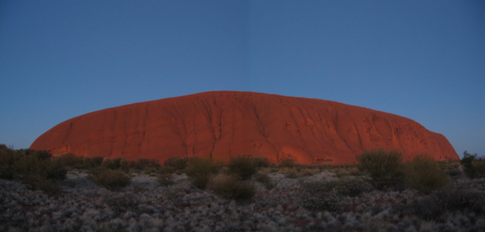
AYRES ROCK JUST BEFORE SUNRISE


AYERS ROCK AT FIRST SUNGLOW


AYERS ROCK RISEN

Excerpt from my book Our Summer in Australia & New Zealand: Amazon.com

Day Eleven. I had been looking forward to this day since first planning the trip to Australia. Climbing Ayers Rock at sunrise! It’s really not dangerous. Since records were kept beginning in 1960, there’s been only one fatality every two years, on average. Considering my life so far, those are very acceptable odds. The joke
going around is that the coroner’s report on the cause of death for people
climbing the Rock is, “death by lens cap” — another tourist dropped something halfway up the rock and forgot the warning not to chase it down. The Rock usually wins. Actually, what fatalities there have been are
from out of condition people (probably American) being overcome and suffering stroke, heart failure or heat prostration in the 115-125 daytime summer heat — otherwise known as natural selection of really dumb people who should not be out climbing The Rock. The indigenous people, the Aborigines, discourage climbing the Rock because of its meaning to them as a sacred symbol. However, for the present, it is still permitted, but perhaps not for much longer, as this is now Aboriginal property. So, today is my one chance. Another photo-op climbing something I shouldn’t. It didn’t work out! Nature interceded. The winds were too high that morning, and the park rangers didn’t want to bother with paperwork explaining what the coroner’s report meant by “got blown away.” While I spent the rest of the day reading Australian history, Elysee, who obviously is much smarter than me, in many ways, and deciding Australian history can wait until next term, spent the day in the heated swimming pool, which is why we were staying at the Lost Camel Hotel in the first place. “Good on yer Elysee.” All I have to show are sunrise pictures of The Rock, taken from about a half mile, which means, because of its size, some digital stitching a slight distortion. Sorry.

Saturday, August 29, 2009

AYERS ROCK-CRISSCROSSING AUSTRALIA


ELEGANCE IN THE DESERT

DINNER SITE OFTEN RELOCATED

SETTING SUN ON KATA TJUTA RANGE MILES DISTANT; NATIVE DIDGERIDOO PLAYING BACKGROUND "MUSIC".

(Excerpted from my book: OUR SUMMER IN AUSTRALIA AND NEW ZEALAND, AMAZON.COM)

Leaving Perth we were once more confronted with the vast emptiness of Australia. The flight from Perth to Ayers Rock is 2260 odd miles, crossing inhospitable terrain, devoid of a trace of Man’s civilizing mark. Frank Lloyd Wright pointed out how nature abhors a straight line. When flying over most of the world’s land mass you can see Man’s imprint below; fence lines, railroad tracks, housing grids, the shapes of ball parks and other geometric sports arenas, and not least of all, multi-storied buildings. Not so, flying over Australia. Within minutes of leaving Perth the
traveler can look down for hours upon nature’s uninterrupted handiwork. Dried riverbeds, long sweeps of red desert dunes, an occasional outcropping, and although they are down there, very little sign of man or beast. Landing at Ayers Rock, a government controlled park area, there are only a few choices of where to stay. On our first evening we attended a twilight dinner called The Sounds of Silence, some miles away in the desert from the complex center. This is an elegant affair, given the desert circumstances, with candlelight, champagne, tablecloths, native food such as kangaroo, emu and crocodile. The dinner site is continuously relocated to lessen any impact on the terrain. The fading light soon gives way to emerging stars. A professional astronomer gave a lecture on the Southern Hemisphere’s night sky,
as more and more nautical twilight faded. The enormous horizon-to-horizon night sky filled with evermore stars, and became strewn with the mist of the Milky Way. Fortunately for us, it was a moonless winter's night, the closest town being 275 miles away, and the desert devoid of air and light pollution. As the last light faded, and Mercury ascended over Mars in the low sky, telescopes and high powered binoculars were made available to further enhance viewing the magnificence of a sky we never see. The sky our grandparents took for granted. The meaning of, and how to read the Southern Cross was explained, Alpha Centurii our closest star was pointed out, and we were asked to hold all conversation and be completely still as we were enveloped by the sounds of silence. Again, to our good fortune, not even the slightest breeze imposed on the naked, soundless, starlit night. Along with all the wine you could drink… it was one hellava night.

Thursday, August 6, 2009

PERTH- CRISSCROSSING AUSTRALIA


EXAMPLE OF VERY VICTORIAN BUILDINGS-FREMANTLE


PANORAMIC VIEW OF MODERN PERTH FROM VICTORIAN HEIGHTS
(Excerpted from my book, OUR SUMMER IN AUSTRALIA AND NEW ZEALAND, AMAZON.COM
We finally made it to Perth! Crossed Australia from Sydney in a week. Now to upgrade and revel in the delights of this big city of 1.3 million. Ah,the Hyatt Regency, Club Floor for three nights. We arrived at 7pm and were being served complimentary cocktails fifteen minutes later, with enough canapés that dining out wasn’t even an option. “Winfield,draw our bath please.” Saturday morning in Perth, Western Australia. Beautiful winter day,clear skies and mid-day temperature about 19c, or 67f, with occasional showers lasting about ten minutes. Boats are out early on the Swan River that runs from Perth to its neighboring port city Fremantle, just 20 minutes away by car, or 45 by ferry. Perth was founded by the British in 1829, and has all the outward skyline appearance of a modern city, while in its heart George IV and Queen Victoria still reign in many of its streets and buildings, especially Fremantle. Like other Australian State Capitals, Perth is oriented towards the ocean and contains 1.3 million of the state’s 1.8 million population. This is a BIG State! Western Australia is a third of the continent, an area of one million square miles, and because of its west coast situation, more oriented towards Africa and Asia than the remainder of Australia. It takes less time to fly from Perth to Singapore than to Sydney. At one time, during the depression of the 1930s, Western Australia even voted for secession, but WWII changed that attitude. Fremantle, or "Freo" in 'Strain, was a major Indian Ocean port for US naval forces during WWII, with submarines taking advantage of its’ proximity.to Japanese shipping throughout the former Dutch East Indies, as well as a home base for US supply and transport ships. Tough duty for WWII! Here is a WWII sailor talking with his son. “Daddy, where were you during the ‘WAR’”. He answers, “Son, I was in the Pacific, in remote Western Australia. Nasty business, WWII, I’d rather not go into detail.” While on the subject of Fremantle, it became what it is one of Australia’s major ports,with closer proximity to Asian markets than Sydney because of C.Y. O’Connor, the same genius who brought the water to Kalgoorlie. Mr. O’Connor built a breakwater and wharf right into the Indian Ocean, where the Swan River empties, thereby creating the port and harbor out of nothing. Today, thanks to C.Y.’s vision, it is one of Australia’s major ports, loading large container ships with Western Australian products on a daily basis. C.Y. was quite a guy, (even if he did take his own life) and a life size statue of the man himself looks out over his creation. Oh yes, in his spare time he designed and oversaw the building of Western Australia’s railroads.

Tuesday, July 7, 2009

CRISSCROSSING AUSTRALIA- A WINE STORY


ALTHOUGH NOT FROM THE MARGARET RIVER AREA, TWO EXAMPLES OF EXCELLENT WINERIES

Excerpted from my book OUR SUMMER IN AUSTRALIA AND NEW ZEALAND, AMAZON.COM
From Point Leeuwin we picked up the pace to the Margaret River region, visiting a
newly opened winery looking very similar the new large “industrial” wineries built recently in California. It was there I confirmed my long held notion that the ubiquitous Australian wine Shiraz was actually Syrah, “flowing,” under different colors. I had to convince the winery guide, who was not accepting my assertion.
In Australia, as in the United States and most other countries (except France,) wines
are sold and labeled according their grape, not their region of growth. Thus, Chardonnay,Merlot, etc., rather than Bordeaux or Burgundy. The situation in Australia, I pointed out to the winery officials, is that there was no grape named “Shiraz.” The grape Australians called Shiraz derives from the Syrah, native to France, and the grape for their great Burgundy label,Hermitage. The guides at the winery were having none of this, so I thumbed through their Australian reference book, located the section on the syrah grape, and was pleased to find there was not only confirmation, but documentation on how Shiraz came to replace Syrah.
The book revealed that the Syrah grape was brought to Australia in 1832 by James Busby, among hundreds of cuttings he gleaned from Europe, to determine their adaptability in Australia. A trial in Sydney’s Botanic Gardens proved the Syrah was very adaptable, and later notes by Sir William Macarthur, a wealthy and influential Australian, writing on Australian wine in the 1840s, referred to “Scyras as an excellent grape…a very hardy plant,produces well…” The reference book I was using brought home my point by adding, “Shiraz,an understandable Strinisation of Macarthur’s Scyras…” What Macarthur had done is what Australians do to this day, reconstruct the English language, speaking "strine," which in itself is taken to mean speaking Australian. So that’s the story from where shiraz originates, and I am pleased to say that the winery guides took this “French Connection” of their Shiraz very well, and thanked me for adding this information to their discussion. No, they didn’tgive me any free plonk; which is strine for cheap wine. It’s very Australian to understand how they get plonk to mean cheap wine. In WWI French soldiers pronounced vin blanc, ordinary French white table wine, van blonk. Having heard Australians for several months I can almost hear them say this when I see the words. But what really makes it strine is when they simplify it altogether by saying simply, plonk. I don’t know how they get from “blonk”to “plonk”, but they do.

Wednesday, June 17, 2009

CRISSCROSSING AUSTRALIA: POINT LEEUWIN


WHERE OCEANS MEET. DESOLETE POINT LLEUWIN

We are about as far away from Sydney as one can get, during our crisscrossing of Australia. About 2,500 miles away. As far as from Boston to San Diego, but let me say that Point Leeuwin is no San Diego. This a point where the Great Southern Ocean and the Indian Ocean meet. It was named by the Dutch and noted by Mathew Flinders' sighting on December 7, 1801 during his historic circumnavigation of the Australian coastline. Flinders' mission-to survey the entire coastline of Australia-was conducted due to growing concern that the French, under Napoleon, were taking a greater interest in Australia, and soon might settle a colony, claiming part of the continent. It was Flinders who first suggested the name Australia from the Latin Terra Australis, or southern land. He proved definitively that New South Wales was not separated from what was then known as New Holland, and in fact Australia was a large, very large contiguous landmass. Unfortunately it was raining when we stopped in this most desolate of places and we were unable to get a photograph of the reknowned Pt. Leeuwin lighthouse. But what you see in the picture is what you get when you stop by. Rocks and ocean, period. As a French girl remarked to me about Australia, sometimes you are absolutely nowhere.

Saturday, April 18, 2009

CRISSCROSSING AUSTRALIA: SW AUSTRALIA & THE TREE TOP WALK


(Excerpted from my book OUR SUMMER IN AUSTRALIA, AMAZON.COM)

I hasten to mention here, as I should have done so when I began relating our cross Australia excursion, that our trip, including the train portion on the Indian Pacific, the Goldrush tours side trip to remote SW Australia, and the Outback stopover (future blog), was all put together with patience and a careful ear to our interests by Julia Lynch, of Adventure Tours and Travel, agent par excellence, in Coogee NSW near Sydney. "Good on ya Julia'.

So, leaving the whaling museum behind we now traveled to the far southwest of Australia just before the Southern Ocean meets the Indian ocean. There you will find a forest named the Valley of the Giants, containing groves of various species of tall trees the grow to heights of 250 feet or more, especially the Tingle (Eucalyptus Jacksonii).

These tree became increasingly endangered as a result of their popularity. The Tingle has a very shallow root system, and as visitors to the area increased, with improved roads and more local resorts, the trees were beginning to show the effects of countless footsteps around their base. One particularly large tree, whose hollowed out base was a favorite photo-op, finally gave in and collapsed in 1990. Something had to be done.

Dr. Syd Shea, who headed a government land management office, had seen a tree top walk while visiting Malaysia. A call was put our for proposals to build a facility along the same concept, the resulted in the brilliant Treetop Walk design. This is a construction of about 1800 feet in length and 120 feet above the forest floor. This ideal solution, allowing thousands of visitors to witness the forest without setting foot on the forest floor is as splendid as it is exhilarating. Elysee and I were fortunate to be there mid-week, off-season, on a slightly rainy day, thus having the area almost to ourselves.

The walk is not strenuous with an incline 1:14, with no steps. The pathway does sway slightly, adding an air of adventure. But even a casual observation of the construction reassures you that there is no danger. The design seems like a reverse of the suspension bridge with the stress downward on the arch. The perspective of casually walking along looking down into the forest is so unusual and at the same time relaxing, that the idea is being studied for other forests, as in Perth. It is a long way to travel, but if you are anywhere near SW Australia, Manjimup, you must do The Tree Top Walk.

Photos: Elysee and I standing inside a large Jacksonii. The hallowing out occurs naturally.
Two photos of the walkway.

Monday, March 23, 2009

CRISSCROSSING AUSTRALIA-DAY SIX- THE WHALING STATION


(Excerpted from my book Our Summer in Australia and New Zealand, Amazon.com)

A highlight of our time in Albany was a visit to the whaling station, which now goes by the unfortunate name of Whale World. The station was the last such large commercial operation to close under pressure from the worldwide bans and restrictive treaties on many form of whaling enacted in the 1970s. The Albany station closed in 1978 and is much like it was then, thereby being a good representative of what the industry was like.

For this modern operation, early in the morning a spotter plane would go to sea to determine if there were any pods, searching within 200 miles of the station. Once whales are located the whaling boats would be dispatched to the exact location. In some cases they would be out and back in the same day, a long one at that, but mostly it would take several days. Killed whales would be pumped with air to keep them afloat, and when sufficient numbers were harvested they would be towed to the whaling station, winched onto the land, flenced (a Norwegian word for stripping the whale), boiled, separated into product and prepared for shipping. Hard work, but mild in comparison to 19th century experience. Then, one spent two years at sea, the product stored below and available for looting by pirates and during war being seized for prize. The Albany station lasted so long because it was so efficient. Day laborers would only be called to work by a factory whistle when the returning boats had product to be rendered. If you are way down under this way it is a worthwhile stopping place.

The city of Albany adapted well to the declining whaling industry. Being surrounded by abundant forest resources authorities are preparing facilities for processing vast quantities of wood chips to feed paper mills in the Far East.. Further on along the coast Albany is installing ultra modern wind farms, which when completed, will supply 75% of the electricity for the city of 25,000. Another example that Australia is aptly named "The Lucky Country."

The picture shows the last whaling ship, quite well preserved and keeping with the Whale World image Elysee in 3d glasses used for viewing a film.

Thursday, February 12, 2009

CRISSCROSSING AUSTRALIA- DAY SIX-ALBANY


THE IMPOSING ANZAC MEMORIAL, ALBANY, WESTERN AUSTRALIA

(Excerpted from my book Our Summer in Australia and New Zealand, Amazon.com)

The seaport town of Albany, located in the southwest portion of Western Australia,near where the great Southern Ocean meets the Indian Ocean, is about as far as one can get "to be far away" without falling off of the edge of the world. By the way, Australians pronounce the name AL as in the mans name and Beny. The city is notable as a former whaling port of some importance, the main point of departure for the WWI ANZAC Armada, a terminal for Australia's timber exports from its abundant forests which provided railroad ties (sleepers in Australia) for English railroads being built throughout the British Empire in its glory days.

At the time of its founding in 1826 there were no settlements anywhere in what is today Western Australia, which amounts to almost half of the continent. Governor Darling sent a military detachment and fifty convicts to establish a lawful presence to contest the use of the area by escaped convicts from Tasmania, and drive out Yankee sealers who were living a renegade lifestyle with captured aborigine women. After five years he withdrew the forces concluding that the area was to inhospitable to attract permanent settlers. Also, Albany was was about to be eclipsed by a more ambitious project on the west coast, Perth, founded two years later. Some struggled on and today the city has about 25,000 residents, a natural port that is thriving, along with a robust tourist trade during the summer months, drawing Western Australians from further north to its cooler climate.

It was at Albany that the ANZAC fleet assembled, sailing off to meet their ill fated destiny on November 2, 1914. It was here that a chaplain from the ANZAC Corps held the first sunrise memorial service commemorating the fateful day of the landing at Gallipoli, April 25, 1915. A solemn dawn service is now held throughout Australia and New Zealand every year on the anniversary of that landing. While the United States has its Veterans Day and Memorial Day to commemorate its service men and women, they have become more holidays, than national days of remembering. Not so in either Australia and New Zealnd, where April 25 each year is taken very seriously and with a greater degree of national participation and respect.(More to follow on the whaling and forest industry.)

Saturday, January 10, 2009

CRISSCROSSING AUSTRALIA- ESPERANCE TELEGRAPH FARM-PART TWO


( Excerpted from my book Our Summer in Australia & New Zealand. Amazon.com)


John Starr, the owner of Telegraph Farm is a man of great imagination and energy. He uses a portion of his farm less suitable for crops or grazing to raise flowers for export, especially to the Japanese market. He plants perennials, providing thereby a renewable product. The Japanese inspect every delivery and if even one insect is found, the entire shipment is denied delivery. In the fading light of the day we gazed over acres of beautiful commercial flower beds. John cut flowers for all the women on board, each leaving with a bouquet containing the Queen Protea, the star of the plantings.

Meanwhile, back at the ranch, Gwen finished preparing a meal using Telegraph Farm products, to be served boarding house style; venison, buffalo, ostrich, bowls of farm fresh vegetables, home baked muffins, and a selection of fine local wines, this being another of Australia's many wine producing regions.
Our stay at telegraph was informative, ending with a large Australian farm meal, and of course a wonderful alternative to the nine foot seas. Hang in the Gwen and John...Good on ya mate!
(Picture of farm raised elk and the queen protea)


Saturday, December 13, 2008

CRISSCROSSING AUSTRALIA-Esperance & Telegraph Farm

(Excerpted from my book Our Summer in Australia and New Zealand Amazon.com)


Hi Elysee, I'm Joe Camel Hey, Anything for us Ostrich's?
After leaving Kalgoorlie we headed south towards Esperance a town in the Great Australian Bight of the southern ocean and about as far from everything as one can get. We were scheduled to visit the Recherche Islands which was the site of great whale and seal hunting grounds from the 19th century. The name for islands were taken from two French ships that explored the area in the early part of the 19th century, raising concerns in London about French colonization and causing the British to spur settlement in the region. Thankfully, due to nine foot seas, our excursion to the islands was cancelled. Instead we visited Telegraph Farm, much to our good fortune. That is a place we easily could have passed by and I consider myself fortunate indeed that we left the pods of seals to another time.

The farm's owners John and Gwen Starr are pioneers in methods of farm diversification as an alternative to raising sheep. Sheep farms in Australia are consolidating, where a minimum of 4,000 sheep are necessary for. The Starr's 1300 acres were becoming insufficient. Instead of giving up farming they went the alternative way.

Animal husbandry is the main feature of Telegraph Farm's strategy. John raises, breeds and cross breeds animals adaptable to Australia, while producing animals that are leaner and more compatible with today's increasing understanding of nutrition and health.

For example, John has both Indian and African Buffalo and their cross strains, the same for African Wapiti, Canadian Elk. and ostrich. These animals are not only leaner they have less impact on the land. For example replacing Herefords with buffalo. During a recent drought the less particular buffalo didn't require feed, being content to graze on the course three foot high grass weeds. Not only that, but being draught animals the buffalo's method of walking is gentle and does not dig up the turf the way cattle do.

John keeps camels mainly for the enjoyment of children as Telegraph Farm is also a center of learning for children for miles around. We had no idea the animals were mostly hand fed and when the door to the van was opened, and Elysee had a bucket of feed in her hand, she was astonished and pleased to come face-to-face with Joe Camel (More on Telegraph Farm in my next posting)


Tuesday, November 25, 2008

CRISSCROSSING AUSTRALIA-KALGOORLIE

The Kalgoorlie Pit. The largest trucks in the world go down there and never return until worn out.

(Extracted from Our Summer in Australia and New Zealand Amazon.com)

Having left the Indian Pacific cross country train at Kalgoorlie, before its final overnight run to Perth, we began day four of our journey back and forth across Australia, with a closer look at the town that epitomizes Australia's former Wild West.
The story begins with an 1892 gold strike in Coolgardie, about 25 miles from present day Kalgoorlie, to which thousands of gold crazed prospectors rushed. Thus when rumors circulated in 1893 that another "find" had been discovered somewhere to the east, about 50 out-of-luck "diggers" left Coolgardie to discover the location of this new mountain of gold. Among them were three hapless, unlucky Irish prospectors named Flanagan, Shea and Patrick Hannon. Hannon's horse became lame and these three lingered behind for the night allowing Hannon time to change the horseshoe. The story is that the lame horse pawed the ground and unearthed a gold nugget.That moment marked the beginning of the richest gold discovery in all Australia, and perhaps the world. Hannon, Shea and Flanagan were soon picking nuggets right off the ground. In a few days Patrick had about 100 ounces, and on June 17, 1893 filed a claim for himself and his two companions, instantly setting off another stampede.

By the end of the year 3000 "diggers" had moved into the area, one of the driest in the world. Many died due to the harsh conditions, water had to be brought 350 miles from Perth, a months journey. Whiskey was free, it was water you paid for.

Since Patrick Hannon picked that 100 ounces of gold off the desert floor over 49,000,000 ounces have been extracted from what is known worldwide as the Golden Mile, the most valuable piece of real estate on the planet. Moreover, it is estimated only half the gold has been extracted. In fact nobody knows. The estimate of future deposits always seems to replace that which has already been extracted.

Friday, November 7, 2008

ACROSS AUSTRALIA BY TRAIN: DAY FOUR


Re-boading the Indian Pacific to begin the run across the barren plain if the Nullarbor.
The conductor had given us a stern warning not to wander too far while in Cook, for once the refueling was complete the train would be leaving for it journey across the Nullarbor, and you don't want to be stranded in the middle of the outback. The Nullarbor (Latin in a way null being none arbor trees...i.e. treeless) is akin to California's Death Valley, but much larger in size. The Indian Pacific travels through this 160,000 square mile arid and treeless plain on the longest straight stretch of rail line in the world; not the slightest deviation for 286 miles. For train rides this is the longest day; a journey where the next meal becomes the highly anticipated event. Bring a good book. I dallied most of the day doing just that, reading the Fatal Shore, about Australia's convict experience; and talking with fellow passengers, mostly Australian, who were, fortunately, the type to make this trip an interesting experience as well.


At about 8pm, we arrived in Kalgoorlie, the site of a historic and immense gold field, and a mile stretch of the world's most expensive real estate. We left the train here, about 500 mils short of its pacific coast destination Perth. If you stay on the train overnight you arrive mid-day on the forth day. Instead we stayed the night in Kalgoorlie, joining a five day bus tour to the far south of Australia along the south sea road, and the Bight of

Australia, then turn north along the Indian Ocean and enter Perth by the "back door", via the Margaret

river wine country. Next I will tell the story about Kalgoorlie, Irish Luck, a US President, and the world richest mine.

Monday, October 13, 2008

ACROSS AUSTRALIA- DAY THREE ON THE INDIAN PACIFIC TRAIN

The hospital tried to stay alive by asking people to get "Crook" sick in Cook
In its "heyday" it cost $3 to play the nine holes. In 100 plus degrees?

After travelling all night from Adelaide we were awakened at 7am in time to prepare for entering the metropolis of Cook; population two. Cook was a town of 300 as recently as 1998; its sole purpose to service the National Railroad. The town boasts a school, swimming pool, hospital, post office and railroad service yards. It even has a golf course without a single blade of grass; a true links course with packed sand greens. The hospital had so little business that amid concerns about being closed by the government, people stopping over on the railroad were encouraged to "...get crook on Cook." (Crook being 'strine for sick).

When the government decided to get out of the railroad business in the '90s, privatizing its interests, Cook became an instant ghost town -an example of how changing government policy can have trickle down consequences.

Today Crook is used only as a changeover point for locomotive drivers, and a refueling stop after a long night run- just before the train starts to cross the Nullibor. This is the only reason we had a chance to stretch our legs. There's no platform, and steps have been placed at the exit doors. The conductor gives us all a stern warning not to cross the tracks, as passing trains in other directions likely will not slow down.. And above all be ready to board when the whistle blows- there are no overnight accommodations in Cook. Not a more desolate railroad stop in the world, with summertime temperatures about 155 degree, and a single digit of annual rainfall. We tried to find some remains of the golf course, but the site could not be distinguished, nature having taken it back. In a few more years there will be little left of this lonely reminder of times past.